Date:
1824
Title:
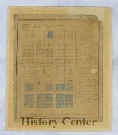
Original Plat
Description:
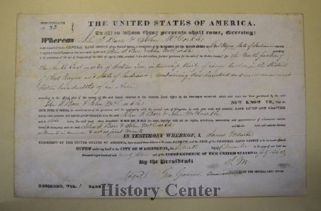
In the Treaty of St. Mary's of 1818, the Miami Indians ceded their claim to a large amount of land to the United States and in 1823 the federal government agreed to open a land office in Fort Wayne and allow the city to be platted. This "Original Plat" of 118 lots over 109 acres became the basis of the emerging town. Bounded by the present streets of Barr, Washington, Superior, and the alley between Calhoun and Harrison, the streets were laid out parallel to Columbia Street-not in a true east-west compass direction. The plat also included a public square with Court Street as its eastern boundary. With the exception of Water Street, which has since been changed to Superior, the streets in the Original Plat retain the names given them in 1823.
The opening of the land office in 1823 had a significant effect on the town's pioneer settlement, al-lowing the public to buy the ceded Miami land. By May 1824, the Original Plat of the city was complete. The city's platting brought forward men who were adventurous entrepreneurs and developers. Sales at the land office boomed, especially after 1835, when there was a surge in land values. Fort Wayne began to grow as additions to the town adjoining the original plat were laid out by early land developers such as Cyrus Taber, Samuel Hanna, the Ewing Family, and William Rockhill.
The opening of the land office in 1823 had a significant effect on the town's pioneer settlement, al-lowing the public to buy the ceded Miami land. By May 1824, the Original Plat of the city was complete. The city's platting brought forward men who were adventurous entrepreneurs and developers. Sales at the land office boomed, especially after 1835, when there was a surge in land values. Fort Wayne began to grow as additions to the town adjoining the original plat were laid out by early land developers such as Cyrus Taber, Samuel Hanna, the Ewing Family, and William Rockhill.


